🌀Twin Hurricanes
Two hurricanes, Humberto and Imelda, are spinning in the Atlantic this week. Instead of making a direct run at the East Coast, they’re caught in a rare Fujiwhara effect — a kind of orbital dance where two storms circle each other and redirect their tracks. For surfers, the significance isn’t about landfall but about energy: when two cyclones move like this, they throw overlapping swell trains across the basin.
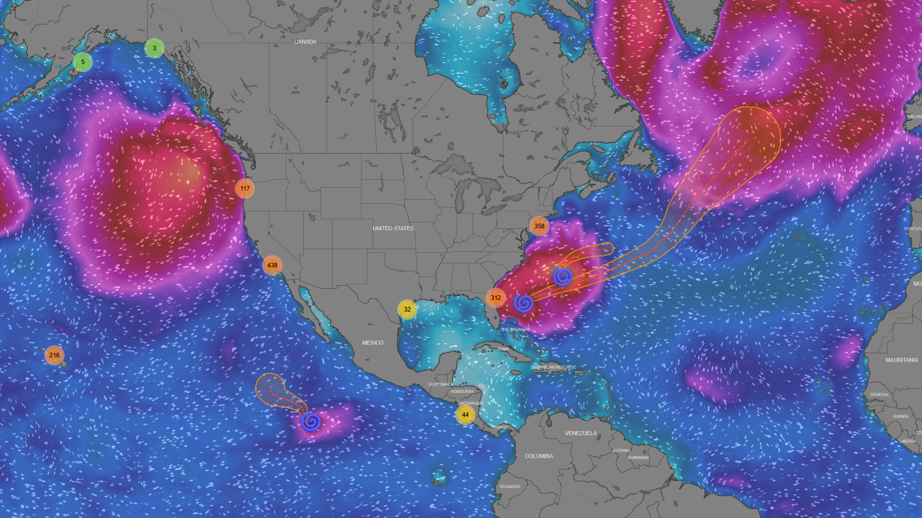
Screenshot from the Shaman app that shows the two hurricanes in the Atlantic.
Humberto, once a Category 4, has weakened but continues to send long-period east-northeast swell into the Atlantic. Imelda is stronger, pushing shorter-period energy into the mix. Together, they’re creating a layered ocean: deep, powerful lines underneath, with shorter, punchier sets stacking on top. The result is a week of shifting conditions that will feel different depending on where you surf along the coast.
South to North: Swell Progression This Week
Florida (Cocoa Beach)
Today (Sept 30): Solid pulse at 1.8 m (~6 ft) with a healthy 13-second period. Clean lines and powerful sets for a region that often misses the better angles.
Midweek (Oct 1–2): Size tapers to the 1.2–1.5 m range, periods shorten slightly, but conditions stay surfable. Winds stay moderate, so mornings should offer windows.
Weekend (Oct 3–4): Holding around 1.5 m, but periods drop closer to 10 s. Energy becomes less organized as Humberto fades and Imelda shifts north. Florida transitions from a strong start into more playful surf by Saturday.
Outer Banks (Frisco, NC)
Today (Sept 30): Peak energy with 2.5 m (~8 ft+) surf and long 13-second periods. Powerful, lined-up conditions, but winds above 11 m/s add challenge.
Midweek: Drops closer to 2 m with 10-second periods — still plenty of juice, but more mixed swell from both storms. Strong currents remain a factor.
Weekend: Surf steadies around 1.5 m, periods around 10 s. More approachable than earlier in the week, though still carrying hurricane power.
New York (Ditch Plains / Montauk)
Today (Sept 30): A healthy 1.4 m (~4–5 ft) with a long 13-second period. Strong but manageable energy for Montauk points and beach breaks.
Midweek (Oct 1–2): Consistency improves, with size holding between 1–1.5 m and periods around 10–11 s. Winds stay lighter than down south, giving better odds for clean conditions.
Weekend (Oct 3–4): Swell fades to under 1 m (~2–3 ft), though periods remain decent at 10 s. By Saturday, New York slides into smaller but cleaner surf — more longboard and fun-board friendly after the midweek punch.
Closing Take
This is a classic East Coast hurricane swell cycle. Florida gets the first hit, with powerful long-period surf tapering by the weekend. The Outer Banks carry the most size and danger, from double overhead to overhead-plus before easing into more user-friendly waves. New York enjoys a sweet spot midweek with clean, rideable energy before things fade to playful sizes by the weekend.
Humberto and Imelda may be locked in their offshore dance, but their rhythm reaches every lineup on the coast. Surfers who follow the swell north will see the story unfold: heavy in the south, powerful through the Banks, and clean but fading by the time it reaches New York.